Laarbeek
Municipality in North Brabant, Netherlands

Flag

Coat of arms
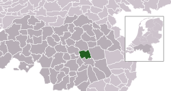
Location in North Brabant
(January 2021)[5]
5735–5741
Laarbeek (Dutch pronunciation: [ˈlaːrbeːk] ⓘ) is a municipality located in the province of North Brabant in the south of the Netherlands. It was formed in 1997 from the former municipalities Beek en Donk, Aarle-Rixtel and Lieshout (which included the village Mariahout). Laarbeek is part of the city region 'Samenwerkingsverband Regio Eindhoven', centered on the city of Eindhoven. The town hall is located in Beek en Donk.
Lieshout is home of the Bavaria Brewery, one of the Netherlands' largest breweries which produces for local and foreign markets.
The Croy Castle is located near the village Aarle-Rixtel.
Population centres
- Achterbosch
- Beemdkant
- Broek
- De Hei
- Deense Hoek
- Ginderdoor
- Groenewoud
- Heikant
- Het Hool
- Het Laar
- 't Hof
- Kruisschot
- Scheepstal
- Strijp
- Wolfsputten
Politics
Municipal government
After the 2022 municipal election, the municipal council of Laarbeek had six parties.[6]
| Party | Seats | |
|---|---|---|
| Partij Nieuw Laarbeek | 6 / 19 | |
| De Werkgroep | 4 / 19 | |
| Algemeen Belang Laarbeek | 4 / 19 | |
| Ouderen Appèl - Hart voor Laarbeek | 2 / 19 | |
| Christian Democratic Appeal | 2 / 19 | |
| Labour Party | 1 / 19 | |
The municipal executive has of four coalition parties: De Werkgroep, Algemeen Belang Laarbeek (ABL), Christian Democratic Appeal (CDA) and Labour (PvdA). Each of these parties has one Alderman in the Board of Mayor and Aldermen (College van Burgemeester en Wethouders).
Topography
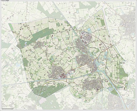
Map of the municipality of Laarbeek, June 2015.
Notable people
- Arnoldus Arlenius (ca.1510–1582) a Dutch humanist philosopher and poet
- Eustáquio van Lieshout (1890 in Aarle-Rixtel – 1943) a Dutch RC missionary in Brazil
- Guus Meeuwis (born 1972 in Mariahout) a Dutch singer-songwriter
- Bram Zwanen (born 1998 in Aarle-Rixtel) a Dutch footballer
Gallery
-
 Aarle-Rixtel Veldkapel Bakelseweg
 -
 Aarle-Rixtel Contraction
 -
 Aarle-Rixtel Cafe Dorpstraat
 -
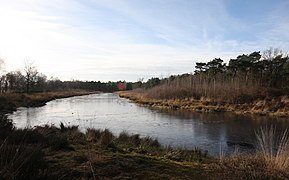 Mariahout Torrenven - panoramio
 -
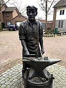 Beek en Donk De Spijkermaker


References
- ^ "Gemeentelijke indeling op 1 januari 1997" [Municipal divisions on 1 January 1997]. cbs.nl (in Dutch). CBS. Retrieved 29 May 2014.
- ^ "Burgemeester Frank van der Meijden" [Frank van der Meijden] (in Dutch). Gemeente Laarbeek. Archived from the original on 28 January 2015. Retrieved 24 January 2015.
- ^ "Kerncijfers wijken en buurten 2020" [Key figures for neighbourhoods 2020]. StatLine (in Dutch). CBS. 24 July 2020. Retrieved 19 September 2020.
- ^ "Postcodetool for 5741GA". Actueel Hoogtebestand Nederland (in Dutch). Het Waterschapshuis. Archived from the original on 21 September 2013. Retrieved 29 May 2014.
- ^ "Bevolkingsontwikkeling; regio per maand" [Population growth; regions per month]. CBS Statline (in Dutch). CBS. 1 January 2021. Retrieved 2 January 2022.
- ^ "Laarbeek municipal election 2022". verkiezingsuitslagen.nl (in Dutch). 16 March 2022. Retrieved 26 April 2024.
External links
 Media related to Laarbeek at Wikimedia Commons
- Official website
Places adjacent to Laarbeek | |
|---|---|


- v
- t
- e
Municipalities of North Brabant
- Alphen-Chaam
- Altena
- Asten
- Baarle-Nassau
- Bergeijk
- Bergen op Zoom
- Bernheze
- Best
- Bladel
- Boekel
- Boxtel
- Breda
- Cranendonck
- Deurne
- Dongen
- Drimmelen
- Eersel
- Eindhoven
- Etten-Leur
- Geertruidenberg
- Geldrop-Mierlo
- Gemert-Bakel
- Gilze en Rijen
- Goirle
- Halderberge
- Heeze-Leende
- Helmond
- 's-Hertogenbosch
- Heusden
- Hilvarenbeek
- Laarbeek
- Land van Cuijk
- Loon op Zand
- Maashorst
- Meierijstad
- Moerdijk
- Nuenen, Gerwen en Nederwetten
- Oirschot
- Oisterwijk
- Oosterhout
- Oss
- Reusel-De Mierden
- Roosendaal
- Rucphen
- Sint-Michielsgestel
- Someren
- Son en Breugel
- Steenbergen
- Tilburg
- Valkenswaard
- Veldhoven
- Vught
- Waalre
- Waalwijk
- Woensdrecht
- Zundert

- See also
- Netherlands
- Provinces
- Municipalities
| Authority control databases: Geographic |
|
|---|


