La France, South Carolina
CDP in South Carolina, United States
34°36′43″N 82°45′55″W / 34.61194°N 82.76528°W / 34.61194; -82.76528 (2020)[3]
29656
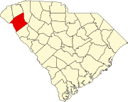
La France is an unincorporated community and census-designated place (CDP) in Anderson County, South Carolina. It was first listed as a CDP in the 2020 census with a population of 476.[4]
La France is located on U.S. Route 76 and South Carolina Highway 28, 10 miles (16 km) northwest of Anderson. La France has a post office with ZIP code 29656, which opened on April 12, 1871.[5][6]
Demographics
| Census | Pop. | Note | %± |
|---|---|---|---|
| 2020 | 476 | — | |
| U.S. Decennial Census[7] 2020[8][3] | |||
2020 census
| Race / Ethnicity | Pop 2020[8] | % 2020 |
|---|---|---|
| White alone (NH) | 391 | 82.14% |
| Black or African American alone (NH) | 30 | 6.30% |
| Native American or Alaska Native alone (NH) | 0 | 0.00% |
| Asian alone (NH) | 1 | 0.21% |
| Pacific Islander alone (NH) | 0 | 0.00% |
| Some Other Race alone (NH) | 2 | 0.42% |
| Mixed Race/Multi-Racial (NH) | 30 | 6.30% |
| Hispanic or Latino (any race) | 22 | 4.62% |
| Total | 476 | 100.00% |
Note: the US Census treats Hispanic/Latino as an ethnic category. This table excludes Latinos from the racial categories and assigns them to a separate category. Hispanics/Latinos can be of any race.
References
- ^ "ArcGIS REST Services Directory". United States Census Bureau. Retrieved October 15, 2022.
- ^ a b U.S. Geological Survey Geographic Names Information System: La France, South Carolina
- ^ a b "Census Population API". United States Census Bureau. Retrieved October 15, 2022.
- ^ "La France CDP, South Carolina". United States Census Bureau. Retrieved April 7, 2022.
- ^ United States Postal Service (2012). "USPS - Look Up a ZIP Code". Retrieved February 15, 2012.
- ^ "Postmaster Finder - Post Offices by ZIP Code". United States Postal Service. Archived from the original on October 17, 2020. Retrieved August 6, 2013.
- ^ "Decennial Census of Population and Housing by Decades". US Census Bureau.
- ^ a b "P2 HISPANIC OR LATINO, AND NOT HISPANIC OR LATINO BY RACE – 2020: DEC Redistricting Data (PL 94-171) – La France CDP, South Carolina". United States Census Bureau.
- v
- t
- e
Municipalities and communities of Anderson County, South Carolina, United States
County seat: Anderson
communities
‡This populated place also has portions in an adjacent county or counties
- South Carolina portal
- United States portal
 | This South Carolina state location article is a stub. You can help Wikipedia by expanding it. |
- v
- t
- e


