Klondike Fire
2018 wildfire in the U.S. state of Oregon
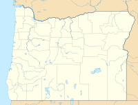

Location of fire in Oregon.


5km
3miles
3miles

Klondike Fire
Location of Klondike Fire
The Klondike Fire was a wildfire in the U.S. state of Oregon. The fire had burned more than 175,258 acres (709 km2).[2] During the fire, a part of the fire was merged into the Taylor Creek Fire, that specific fire, had burned 52,839 acres (214 km2).
Fire growth and containment progress
| Date | Area burned acres (km2) | Containment | ||
|---|---|---|---|---|
| Aug 7 | 28,746 (116) | 5% | ||
| Aug 8 | 35,072 (142) | 15% | ||
| Aug 9 | 36,876 (149) | 15% | ||
| Aug 10 | 38,382 (155) | 15% | ||
| Aug 11 | 47,030 (190) | 15% | ||
| Aug 12 | 51,120 (207) | 15% | ||
| Aug 13 | 55,248 (224) | 15% | ||
| Aug 14 | 55,248 (224) | 15% | ||
| Aug 15 | 57,325 (232) | 15% | ||
| Aug 16 | 59,015 (239) | 15% | ||
| Aug 17 | 62,731 (254) | 15% | ||
| Aug 18 | 66,332 (268) | 15% | ||
| Aug 19 | 68,241 (276) | 15% | ||
| Aug 20 | 72,074 (292) | 28% | ||
| Aug 21 | 76,098 (308) | 32% | ||
| Aug 22 | 76,098 (308) | 33% | ||
| Aug 23 | 79,501 (322) | 37% | ||
| Sep 9 | 130,258 (527) | 51% | ||
| Oct 31 | 175,258 (709) | 80% | ||
| Nov 1 | 175,258 (709) | 80% | ||
| Nov 2 | 175,258 (709) | 80% | ||
| Nov 3 | 175,258 (709) | 90% |
References
 Oregon portal

- v
- t
- e
- Yacolt (1902)
- Tillamook (1933–1951)
- Biscuit (2002)
- B&B (2003)
- Tumblebug (2009)
- Lava (2012)
- Long Draw (2012)
- Barry Point (2013)
- Chetco Bar
- Cinder Butte
- Eagle Creek
- High Cascades Complex
- Milli
- Nash
- Whitewater
 Category
 Commons

 | This Oregon-related article is a stub. You can help Wikipedia by expanding it. |
- v
- t
- e


