King Island Council
Local government area in Tasmania, Australia
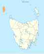
39°51′49″S 143°59′06″E / 39.8637°S 143.9851°E / -39.8637; 143.9851| LGAs around King Island Council: | ||
| Bass Strait | Bass Strait | Bass Strait |
| Bass Strait | King Island Council | Bass Strait |
| Bass Strait | Bass Strait | Circular Head |
King Island Council is a local government body in Tasmania, encompassing King Island and the adjacent minor islands within Bass Strait, in the north-west of the state. The King Island local government area is classified as rural and has a population of 1,601,[1] with Currie as the main town and administrative centre.
History and attributes
The King Island municipality was established on 1 January 1907[2] King Island is classified as rural, agricultural and small (RAS) under the Australian Classification of Local Governments.[3]
Council
Current composition
| Name | Position[4] | Party | |
|---|---|---|---|
| Marcus Blackie | Mayor | Independent | |
| Vernon Philbey | Deputy Mayor | Independent | |
| Phillip Richards | Councillor | Independent | |
| Ian Allan | Councillor | Independent | |
| Ira Cooke | Councillor | Independent | |
| David Bowden | Councillor | Independent | |
| Gina Green | Councillor | Independent | |
| Anna Hely | Councillor | Independent | |
| Sarina Laidler | Councillor | Independent | |
| Duncan McFie | Councillor | Independent | |
2022 election results
This section is an excerpt from Results of the 2022 Tasmanian local elections § King Island.[edit]
One vacancy was not filled and a by-election was held on 27 October 2022.
| Party | Candidate | Votes | % | ±% | |
|---|---|---|---|---|---|
| Independent | Ian Allan (elected) | unopposed | |||
| Independent | Marcus Blackie (elected) | unopposed | |||
| Independent | David Bowden (elected) | unopposed | |||
| Independent | Ira Cooke (elected) | unopposed | |||
| Independent | Gina Green (elected) | unopposed | |||
| Independent | Sarina Laidler (elected) | unopposed | |||
| Independent | Duncan McFie (elected) | unopposed | |||
| Independent | Vernon Philbey (elected) | unopposed | |||
| Registered electors | 1,179 | ||||
Localities
- Bungaree
- Currie
- Egg Lagoon
- Grassy
- Loorana
- Lymwood
- Naracoopa
- Nugara
- Pearshape
- Pegarah
- Reekara
- Sea Elephant
- Surprise Bay
- Wickham
- Yambacoona
- Yarra Creek
See also
References
- ^ a b c "3218.0 – Regional Population Growth, Australia, 2017-18: Population Estimates by Local Government Area (ASGS 2018), 2017 to 2018". Australian Bureau of Statistics. Australian Bureau of Statistics. 27 March 2019. Retrieved 25 October 2019. Estimated resident population, 30 June 2018.
- ^ a b "Agency Details: King Island Municipal Council". search.archives.tas.gov.au. Tasmanian Government. Retrieved 11 June 2018.
- ^ "Local government national report 2014-2015". regional.gov.au. Australian Government. Retrieved 8 June 2018.
- ^ https://kingisland.tas.gov.au/council/know-your-council/elected-members/
- ^ "King Island Council". Tasmanian Electoral Commission.
External links
- King Island Council official website
- Local Government Association Tasmania
- Tasmanian Electoral Commission - local government
- v
- t
- e
- Break O'Day
- Brighton
- Burnie
- Central Coast
- Central Highlands
- Circular Head
- Clarence
- Derwent Valley
- Devonport
- Dorset
- Flinders
- George Town
- Glamorgan–Spring Bay
- Glenorchy
- Hobart
- Huon Valley
- Kentish
- King Island
- Kingborough
- Latrobe
- Launceston
- Meander Valley
- Northern Midlands
- Sorell
- Southern Midlands
- Tasman
- Waratah–Wynyard
- West Coast
- West Tamar


