Municipality in Southeast, Brazil

Flag

Coat of arms
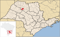 Location in São Paulo state |
| 21°03′10″S 49°41′16″W / 21.05278°S 49.68778°W / -21.05278; -49.68778 |
| Country | Brazil |
|---|
| Region | Southeast |
|---|
| State | São Paulo |
|---|
| Mesoregion | São José do Rio Preto |
|---|
| Microregion | São José do Rio Preto |
|---|
| Area |
|---|
| • Total | 859.94 km2 (332.02 sq mi) |
|---|
| Elevation | 458 m (1,503 ft) |
|---|
| Population |
|---|
| • Total | 37,366 |
|---|
| • Density | 43/km2 (110/sq mi) |
|---|
| Time zone | UTC−3 (BRT) |
|---|
| Postal code | 15200-000 |
|---|
| Area code | +55 17 |
|---|
| Website | www.josebonifacio.sp.gov.br |
|---|
José Bonifácio is a municipality in the state of São Paulo, Brazil. The population is of 37,366 inhabitants and the area is 859.94 km2.[2] The city belongs to the Microregion of São José do Rio Preto.
History
The history of José Bonifácio begins in 1906. The founder of the city, José Crescencio de Souza, built the first three houses. In 1910, the brothers Manuel, Justino e Carlos Rodrigues de Sant’Anna donated part of their land to the Catholic Church. The first chapel was built in 1913, and the town received the name of Cerradão.
In 1914, the town was elevated to district and on December 23, 1924, became a district of Mirassol, changing its name to the current form. José Bonifácio was officially established as a municipality on December 28, 1926.[3]
Economy
The Tertiary sector is the economic basis of Bonifácio. Commerce, services and administration corresponds to 62.3% of the city GDP. Industry is 29.2% of the GDP, and the Primary sector corresponds to 8.5%.[4]
Transportation
- BR-153 - Rodovia Transbrasiliana
- SP-425 - Rodovia Assis Chateaubriand
References
- ^ IBGE 2020
- ^ "2010 Census of the IBGE - Population - Table 2.1.20" (PDF). IBGE.gov.br. Retrieved 13 July 2011.
- ^ "History of the City". Josebonifacio.sp.gov.br. Retrieved 15 July 2011.
- ^ "Municipal Profile at SEADE". SEADE.gov.br. Archived from the original on 23 August 2011. Retrieved 15 July 2011.
State of São Paulo, Brazil
|
|
|
|---|
| Capital | |
|---|
| 1,000,000+ | |
|---|
| 500,000+ | |
|---|
| 200,000+ | |
|---|
| 100,000+ | |
|---|
|
|
|
|---|
São José do Rio Preto |
|---|
| Auriflama | |
|---|
| Catanduva | |
|---|
| Fernandópolis | |
|---|
| Jales | |
|---|
| Nhandeara | |
|---|
| Novo Horizonte | |
|---|
| São José do Rio Preto | |
|---|
| Votuporanga | |
|---|
|
|
|
|
|---|
|
Araçatuba |
|---|
| Andradina | |
|---|
| Araçatuba | |
|---|
| Birigui | |
|---|
|
| |
|
|
Bauru |
|---|
| Avaré | |
|---|
| Bauru | |
|---|
| Botucatu | |
|---|
| Jaú | |
|---|
| Lins | |
|---|
|
|
Campinas |
|---|
| Amparo | |
|---|
| Campinas | |
|---|
| Mogi Mirim | |
|---|
| Pirassununga | |
|---|
| São João da Boa Vista | |
|---|
|
|
Itapetininga |
|---|
| Capão Bonito | |
|---|
| Itapetininga | |
|---|
| Itapeva | |
|---|
| Tatuí | |
|---|
|
|
|
Macro Metropolitana Paulista |
|---|
| Bragança Paulista | |
|---|
| Jundiaí | |
|---|
| Piedade | |
|---|
| Sorocaba | |
|---|
|
|
|
Metropolitana de São Paulo |
|---|
| Franco da Rocha | |
|---|
| Guarulhos | |
|---|
| Itapecerica da Serra | |
|---|
| Mogi das Cruzes | |
|---|
| Osasco | |
|---|
| Santos | |
|---|
| São Paulo | |
|---|
|
|
Piracicaba |
|---|
| Limeira | |
|---|
| Piracicaba | |
|---|
| Rio Claro | |
|---|
|
|
Presidente Prudente |
|---|
| Adamantina | |
|---|
| Dracena | |
|---|
| Presidente Prudente | |
|---|
|
|
Ribeirão Preto |
|---|
| Barretos | |
|---|
| Batatais | |
|---|
| Franca | |
|---|
| Ituverava | |
|---|
| Jaboticabal | |
|---|
| Ribeirão Preto | |
|---|
| São Joaquim da Barra | |
|---|
|
|
São José do Rio Preto |
|---|
| Auriflama | |
|---|
| Catanduva | |
|---|
| Fernandópolis | |
|---|
| Jales | |
|---|
| Nhandeara | |
|---|
| Novo Horizonte | |
|---|
| São José do Rio Preto | |
|---|
| Votuporanga | |
|---|
|
|
Vale do Paraíba Paulista |
|---|
| Bananal | |
|---|
| Campos do Jordão | |
|---|
| Caraguatatuba | |
|---|
| Guaratinguetá | |
|---|
| Paraibuna/Paraitinga | |
|---|
| São José dos Campos | |
|---|
|
|
 | This geographical article relating to the state of São Paulo is a stub. You can help Wikipedia by expanding it. |


