Ilopango
You can help expand this article with text translated from the corresponding article in Spanish. (December 2008) Click [show] for important translation instructions.
- View a machine-translated version of the Spanish article.
- Machine translation, like DeepL or Google Translate, is a useful starting point for translations, but translators must revise errors as necessary and confirm that the translation is accurate, rather than simply copy-pasting machine-translated text into the English Wikipedia.
- Do not translate text that appears unreliable or low-quality. If possible, verify the text with references provided in the foreign-language article.
- You must provide copyright attribution in the edit summary accompanying your translation by providing an interlanguage link to the source of your translation. A model attribution edit summary is
Content in this edit is translated from the existing Spanish Wikipedia article at [[:es:Ilopango]]; see its history for attribution. - You may also add the template
{{Translated|es|Ilopango}}to the talk page. - For more guidance, see Wikipedia:Translation.
Municipality in San Salvador Department, El Salvador
13°42′N 89°07′W / 13.700°N 89.117°W / 13.700; -89.117 (2009)
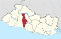
Ilopango is a town in the San Salvador department of El Salvador. It is a few miles east of the nation's capital, San Salvador. It is located near Lake Ilopango, the country's largest lake at 72 square kilometers.
Overview

El Salvador's second airport is in Ilopango. It is currently used for charter flights and by the Salvadoran military but plans are underway to increase its use as tourism and travel in El Salvador increase and Comalapa International Airport cannot handle the future influx alone.[citation needed] The Civil Aviation Authority has its headquarters on the airport property,[2] in Ilopango.[3]
References
- ^ "elsalvador.com, Ediles electos de ARENA no despedirán a empleados". Elsalvador.com. Retrieved 2012-03-17.
- ^ Home. Civil Aviation Authority. Retrieved on January 5, 2013. "Km 9 1/2 Boulevard del Ejercito Nacional, Aeropuerto Ilopango, El Salvador"
- ^ "Contactenos." (Archive ) Civil Aviation Authority. Retrieved on June 9, 2009. "*Dirección Boulevard del Ejército Km. 9 1/2, contiguo Zona Franca San Bartolo. Ilopango"
External links
 El Salvador portal

![]() Media related to Ilopango at Wikimedia Commons
Media related to Ilopango at Wikimedia Commons
- v
- t
- e
 San Salvador Department
Capital: San Salvador
- Aguilares
- Apopa
- Ayutuxtepeque
- Cuscatancingo
- Delgado
- El Paisnal
- Guazapa
- Ilopango
- Mejicanos
- Nejapa
- Panchimalco
- Rosario de Mora
- San Marcos
- San Martín
- San Salvador
- Santiago Texacuangos
- Santo Tomás
- Soyapango
- Tonacatepeque
- Cerro Cinotepeque
- Cerrón Grande Reservoir
- Guazapa Volcano
- Lake Ilopango
- Casa Presidencial
- Cemetery of Distinguished Citizens
- Estadio Cuscatlán
- Estadio Jorge "Mágico" González
- Estadio Las Delicias
- Estadio Nacional de El Salvador
- Estadio Universitario UES
- Gimnasio Nacional José Adolfo Pineda
- Government Center Tower
- Iglesia El Carmen
- Ilopango International Airport
- Lifestyle Center La Gran Via
- Monumento al Divino Salvador del Mundo
- Museo de la Palabra y la Imagen
- National Palace
- Plaza Gerardo Barrios
- San Salvador Cathedral
- San Salvador Historic Downtown
- Teatro Nacional de El Salvador
- World Trade Center San Salvador
Authority control databases | |
|---|---|
| International |
|
| National |
|
13°42′N 89°07′W / 13.700°N 89.117°W / 13.700; -89.117
 | This El Salvador location article is a stub. You can help Wikipedia by expanding it. |
- v
- t
- e


