Hirzenbach
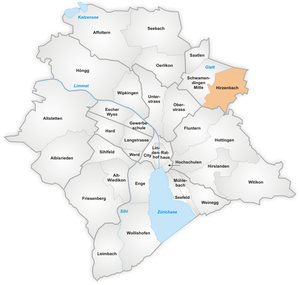


Hirzenbach is a quarter in the district 12 of Zürich, located in the Glatt Valley (German: Glattal).
It was part of Schwamendingen municipality that was amalgamated into Zürich in 1934.
The quarter has a population of 11,265 distributed on an area of 2.62 km2 (1.01 sq mi).
References
![]() Media related to Hirzenbach at Wikimedia Commons
Media related to Hirzenbach at Wikimedia Commons
47°24′16.66″N 8°35′14.31″E / 47.4046278°N 8.5873083°E / 47.4046278; 8.5873083
- v
- t
- e
Quarters in the city of Zürich
- Affoltern
- Albisrieden
- Altstetten
- City
- Enge
- Escher Wyss
- Fluntern
- Friesenberg
- Gewerbeschule
- Hard
- Hirslanden
- Hirzenbach
- Hochschulen
- Höngg
- Hottingen
- Langstrasse
- Leimbach
- Lindenhof
- Mühlebach
- Oberstrass
- Oerlikon
- Rathaus
- Saatlen
- Schipfe
- Schwamendingen Mitte
- Seebach
- Seefeld
- Sihlfeld
- Unterstrass
- Weinegg
- Werd
- (Alt-)Wiedikon
- Wipkingen
- Witikon
- Wollishofen

 | This Canton of Zürich location article is a stub. You can help Wikipedia by expanding it. |
- v
- t
- e


