Guadalupe Victoria, Puebla
Municipality in Puebla, Mexico

Seal
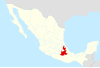
 Mexico
 (2005)Municipality
Guadalupe Victoria Municipality is a municipality in the Mexican state of Puebla. According to the National Statistics Institute (INEGI), it had a population of 15,041 inhabitants in the 2005 census. Its total area is 239.83 km². It is named after Guadalupe Victoria, the first president of Mexico.
Its geographical coordinates are 19° 17′ North, and 97° 20′ West. Its average altitude is 2,440 metres (8,005 ft) above sea level. Its highest elevation is the rhyolitic twin dome volcano Las Derrumbadas (3480 m).
External links
- https://web.archive.org/web/20070324000550/http://www.e-local.gob.mx/work/templates/enciclo/puebla/Mpios/21067a.htm
- v
- t
- e
 State of Puebla
Puebla (capital)
towns
- Acajete
- Acateno
- Acatzingo
- Acteopan
- Ahuacatlán
- Ahuatlán
- Ahuazotepec
- Ahuehuetitla
- Ajalpan
- Albino Zertuche
- Aljojuca
- Altepexi
- Amixtlán
- Amozoc
- Aquixtla
- Atempan
- Atexcal
- Atlequizayan
- Atlixco
- Atoyatempan
- Atzala
- Atzitzihuacán
- Atzitzintla
- Axutla
- Ayotoxco de Guerrero
- Calpan
- Caltepec
- Camocuautla
- Cañada Morelos
- Caxhuacan
- Coatepec
- Coatzingo
- Cohetzala
- Cohuecán
- Coronango
- Coxcatlán
- Coyomeapan
- Coyotepec
- Cuapiaxtla de Madero
- Cuautempan
- Cuautinchán
- Cuautlancingo
- Cuayuca de Andrade
- Cuetzalan del Progreso
- Cuyoaco
- Chalchicomula de Sesma
- Chapulco
- Chiautla de Tapia
- Chiautzingo
- Chiconcuautla
- Chichiquila
- Chietla
- Chigmecatitlán
- Chignahuapan
- Chignautla
- Chila
- Chila de la Sal
- Chilchotla
- Chinantla
- Domingo Arenas
- Eloxochitlán
- Epatlán
- Esperanza
- Francisco Z. Mena
- General Felipe Angeles
- Guadalupe
- Guadalupe Victoria
- Hermenegildo Galeana
- Honey
- Huaquechula
- Huatlatlauca
- Huauchinango
- Huehuetla
- Huehuetlán el Chico
- Huehuetlán el Grande
- Huejotzingo
- Hueyapan
- Hueytamalco
- Hueytlalpan
- Huitzilan de Serdán
- Huitziltepec
- Ixcamilpa de Guerrero
- Ixcaquixtla
- Ixtacamaxtitlán
- Ixtepec
- Izúcar de Matamoros
- Jalpan
- Jolalpan
- Jonotla
- Jopala
- Juan C. Bonilla
- Juan Galindo
- Juan N. Méndez
- Lafragua
- Libres
- Magdalena Tlatlauquitepec, La
- Mazapiltepec de Juárez
- Mixtla
- Molcaxac
- Naupan
- Nauzontla
- Nealtican
- Nicolás Bravo
- Nopalucan
- Ocotepec
- Ocoyucan
- Olintla
- Oriental
- Pahuatlán
- Palmar de Bravo
- Pantepec
- Petlalcingo
- Piaxtla
- Puebla
- Quecholac
- Quimixtlán
- Rafael Lara Grajales
- Reyes de Juárez, Los
- San Andrés Cholula
- San Antonio Cañada
- San Diego la Meza Tochimiltzingo
- San Felipe Teotlalcingo
- San Felipe Tepatlán
- San Gabriel Chilac
- San Gregorio Atzompa
- San Jerónimo Tecuanipan
- San Jerónimo Xayacatlán
- San José Chiapa
- San José Miahuatlán
- San Juan Atenco
- San Juan Atzompa
- San Juan Raboso
- San Martín Texmelucan
- San Martín Totoltepec
- San Matías Tlalancaleca
- San Miguel Ixitlán
- San Miguel Xoxtla
- San Nicolás Buenos Aires
- San Nicolás de Los Ranchos
- San Pablo Anicano
- San Pedro Cholula
- San Pedro Yeloixtlahuaca
- San Salvador el Seco
- San Salvador el Verde
- San Salvador Huixcolotla
- San Sebastián Tlacotepec
- Santa Catarina Tlaltempan
- Santa Inés Ahuatempan
- Santa Isabel Cholula
- Santiago Miahuatlán
- Santo Tomás Hueyotlipan
- Soltepec
- Tecali de Herrera
- Tecamachalco
- Tecomatlán
- Tehuacán
- Tehuitzingo
- Tenampulco
- Teopantlán
- Teotlalco
- Tepanco de López
- Tepango de Rodríguez
- Tepatlaxco de Hidalgo
- Tepeaca
- Tepemaxalco
- Tepeojuma
- Tepetzintla
- Tepexco
- Tepexi de Rodríguez
- Tepeyahualco
- Tepeyahualco de Cuauhtémoc
- Tetela de Ocampo
- Teteles de Ávila Castillo
- Teziutlán
- Tianguismanalco
- Tilapa
- Tlacotepec de Benito Juárez
- Tlacuilotepec
- Tlachichuca
- Tlahuapan
- Tlaltenango
- Tlanepantla
- Tlaola
- Tlapacoya
- Tlapanalá
- Tlatlauquitepec
- Tlaxco
- Tochimilco
- Tochtepec
- Totoltepec de Guerrero
- Tulcingo
- Tuzamapan de Galeana
- Tzicatlacoyan
- Venustiano Carranza
- Vicente Guerrero
- Xayacatlán de Bravo
- Xicotepec
- Xicotlán
- Xiutetelco
- Xochiapulco
- Xochiltepec
- Xochitlán de Vicente Suárez
- Xochitlán Todos Santos
- Yaonáhuac
- Yehualtepec
- Zacapala
- Zacapoaxtla
- Zacatlán
- Zapotitlán
- Zapotitlán de Méndez
- Zaragoza
- Zautla
- Zihuateutla
- Zinacatepec
- Zongozotla
- Zoquiapan
- Zoquitlán
Authority control databases | |
|---|---|
| International |
|
| National |
|


