Graška Gora
Place in Styria, Slovenia
46°25′57.43″N 15°6′59.3″E / 46.4326194°N 15.116472°E / 46.4326194; 15.116472 Slovenia
 (2002)
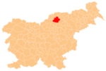
Graška Gora (pronounced [ˈɡɾaːʃka ˈɡɔːɾa]; German: Grazerberg[2]) is a dispersed settlement in the City Municipality of Slovenj Gradec in northern Slovenia. The area is part of the traditional region of Styria. The entire municipality is now included in the Carinthia Statistical Region.[3]
The local church north of the settlement, in the territory of the neighbouring settlement of Šmiklavž, is dedicated to Saint Helena and belongs to the Parish of Šmiklavž. The earliest phases of the building date to the 13th century.[4]
References
- ^ Statistical Office of the Republic of Slovenia
- ^ K. K. Statistischen Central-Commission (1883). Orts-Repertorien der im Oesterreichischen Reichsrathe Vertretenen Königreiche und Lander. IV. Steiermark. Vienna: K. K. Statistischen Central-Commission. p. 260.
- ^ Slovenj Gradec municipal site
- ^ Slovenian Ministry of Culture register of national heritage reference number ešd 3186
External links
- Graška Gora on Geopedia
- v
- t
- e
Administrative seat: Slovenj Gradec
| Current |
|
|---|---|
| Former |
|
- Holy Spirit Chapel
- Rothenturn Mansion
- St. Elizabeth's Parish Church
 | This article about the Municipality of Slovenj Gradec in Slovenia is a stub. You can help Wikipedia by expanding it. |
- v
- t
- e


