Frogmore Mound Site
31°36′17″N 91°40′15″W / 31.60466°N 91.67078°W / 31.60466; -91.67078
United States historic place
Frogmore (16CO9) | |
| Location | Address restricted[2] |
|---|---|
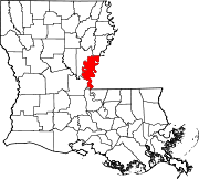
| Nearest city | Ferriday, Louisiana |
| NRHP reference No. | 04000740[1] |
| Added to NRHP | July 28, 2004 |
Frogmore Mound Site (16 CO 9) is an archaeological site of the Late Coles Creek culture in Concordia Parish, Louisiana. The site is located 7 miles (11 km) west of Ferriday on US 84.[3] It was added to the National Register of Historic Places on July 28, 2004.[1]
Description
The site consists of a platform mound and associated village area with middens covering an area roughly 400 feet (120 m) by 200 feet (61 m). The site originally had a walled ceremonial structure 20 feet (6.1 m) to 30 feet (9.1 m) in diameter. This structure was burned and subsequently covered with dirt. A mound, constructed in two stages very near each other chronologically, was built over top of the structure. The rectangular mound now measures 14 feet (4.3 m) in height, with the base being 160 feet (49 m) by 190 feet (58 m), and the summit 60 feet (18 m) by 70 feet (21 m).[3]
Excavations at the site have produced charcoal from beneath the mound that dates to 1020–1260 CE. Pottery recovered from the midden places the occupation of the site to the Late Coles Creek period.[3]
Frogmore archeological site
As stated in NRHP registration form:[4]
[This] is a single platform mound and village midden site that dates to the Ballina-Balmoral phases (ca. A.D. 900-1050) of the Coles Creek period (A.D. 700-1200) (Cusick et al. 1995). The site is adjacent to U. S. Highway 84 approximately 100 m south/southeast of the confluence of Otto Bayou and Brushy Bayou. It is set in a wetlands environment on a historic cotton plantation of the same name ... The mound is generally oriented to the cardinal directions, with the long axis running east-west. A buried village midden is on the north side of the mound.
The Frogmore site is next to an old meander scar of the Mississippi River and an abandoned channel of the Tensas River (Saucier 1994). The mound is constructed on Mississippi backswamp sediments that overlap point bar deposits of Mississippi Meaner Belt 2 that are between 4400-2400 years in age (Saucier 1994). Archaeologist James Ford speculated in 1936 that Frogmore was abandoned when the Tensas River shifted approximately 2 miles to the west, or to its present course (Ford 1936:238). Coles Creek ceramic types, the method of construction of a submound walled structure, and one radiocarbon date from the midden have established the age of the mound.
The site area is approximately 50 m x 80m. The long axis, composed of the mound and the village midden north of the mound, is oriented to the northeast and southwest. The platform mound is rectangular in plan view, measuring 5 m. The mound is constructed in two states and made with sandy and clay fill that covers a double walled circular structure and associated village midden.
See also
- Culture, phase, and chronological table for the Mississippi Valley
- DePrato Mounds
- Frogmore Plantation
- Piazza Cotton Gin, also located in Frogmore Plantation
- National Register of Historic Places listings in Concordia Parish, Louisiana
References
- ^ a b "National Register Information System". National Register of Historic Places. National Park Service. July 9, 2010.
- ^ Federal and state laws and practices restrict general public access to information regarding the specific location of this resource. In some cases, this is to protect archeological sites from vandalism, while in other cases it is restricted at the request of the owner. See: Knoerl, John; Miller, Diane; Shrimpton, Rebecca H. (1990), Guidelines for Restricting Information about Historic and Prehistoric Resources, National Register Bulletin, National Park Service, U.S. Department of the Interior, OCLC 20706997.
- ^ a b c "Indian Mounds of Northeast Louisiana:Frogmore Mound". Archived from the original on December 24, 2012. Retrieved October 17, 2011.
- ^ "Frogmore" (PDF). State of Louisiana's Division of Historic Preservation. 1980. Retrieved July 31, 2017. with two photos
External links
Wikimedia Commons has media related to Frogmore Mound Site.
- Louisiana Life Magazine:Mounds of Mystery Archived April 6, 2012, at the Wayback Machine
- Historical Marker Database: Ancient Mounds Trail - Frogmore Mound
- v
- t
- e
- Late Woodland period
- List of archaeological periods (North America)
- Aden site
- Balmoral Mounds
- Boone's Mounds
- Churupa Plantation Mound
- Coles Creek Site
- Crippen Point site
- Cypress Grove Mound
- DePrato Mounds
- Feltus Mound Site
- Filhiol Mound Site
- Fisher site
- Flowery Mound
- Frogmore Mound Site
- Ghost Site Mounds
- Greenhouse site
- Insley Mounds
- Kings Crossing site
- Lamarque Landing Mound
- Marsden Mounds
- Mazique Archeological Site
- Mott Mounds
- Mound Plantation
- Peck Mounds
- Raffman site
- Scott Place Mounds
- Shackleford Church Mounds
- Spanish Fort
- Sundown Mounds
- Transylvania Mounds
- Troyville Earthworks
- Venable Mound
- Wade Landing Mound

Coles Creek sites
- Atchafalaya Basin Mounds
- Bayou Black Mound (16TR78)
- Bayou Cypremont (16SMY7)
- Bayou Grande Cheniere Mounds
- Bayou L’Ours Site
- Bayou Portage Mounds
- Bayou Sorrel Mounds (16IV4)
- Clovelly Site (16LF64)
- Cypress Point Site (16VM112)
- Eagle Point Site (16IB123)
- Gibson Mounds (16TR5)
- Greenwood Cemetery Site (16SMY10)
- Kleinpeter Mounds
- Little Cheniere Site (16CM22)
- Little Pecan Island Site
- Jerry Haas Site (16SJ51)
- Machias Lake (16SB2)
- Morgan Mounds
- Pecan Mounds (16SM37)
- Pennison Mounds (16AS16)
- Portage Mounds (16SM5)
- Richeau Field Site (16TR82)
- Schwing Place Mound (16IV13)
- Sims site
- Southwest of Cut Off Lagoon (16SB50)
- St. Gabriel Mounds (16IV128)
- Temple Mounds Site (16LF4)
- Baytown Site
- Chandler Landing Site
- Coy Site
- Dogtown Site
- Hayes site
- Maberry Site
- Plum Bayou Mounds
- Roland Site


Portal:
 National Register of Historic Places