Fürstenzell
You can help expand this article with text translated from the corresponding article in German. (March 2009) Click [show] for important translation instructions.
- View a machine-translated version of the German article.
- Machine translation, like DeepL or Google Translate, is a useful starting point for translations, but translators must revise errors as necessary and confirm that the translation is accurate, rather than simply copy-pasting machine-translated text into the English Wikipedia.
- Do not translate text that appears unreliable or low-quality. If possible, verify the text with references provided in the foreign-language article.
- You must provide copyright attribution in the edit summary accompanying your translation by providing an interlanguage link to the source of your translation. A model attribution edit summary is
Content in this edit is translated from the existing German Wikipedia article at [[:de:Fürstenzell]]; see its history for attribution. - You may also add the template
{{Translated|de|Fürstenzell}}to the talk page. - For more guidance, see Wikipedia:Translation.
Municipality in Bavaria, Germany

Coat of arms
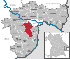
Location of Fürstenzell within Passau district
(2022-12-31)[2]
94081
Fürstenzell (Central Bavarian: Fiaschtnzei) is a municipality in the district of Passau in Bavaria in Germany.
Climate
| Climate data for Fürstenzell (1991–2020 normals) | |||||||||||||
|---|---|---|---|---|---|---|---|---|---|---|---|---|---|
| Month | Jan | Feb | Mar | Apr | May | Jun | Jul | Aug | Sep | Oct | Nov | Dec | Year |
| Mean daily maximum °C (°F) | 1.3 (34.3) | 3.8 (38.8) | 8.8 (47.8) | 14.7 (58.5) | 18.9 (66.0) | 22.5 (72.5) | 24.0 (75.2) | 23.8 (74.8) | 18.8 (65.8) | 13.0 (55.4) | 6.4 (43.5) | 2.3 (36.1) | 13.2 (55.8) |
| Daily mean °C (°F) | −1.2 (29.8) | 0.5 (32.9) | 4.5 (40.1) | 9.5 (49.1) | 13.8 (56.8) | 17.3 (63.1) | 18.6 (65.5) | 18.5 (65.3) | 13.9 (57.0) | 9.0 (48.2) | 3.6 (38.5) | 0.0 (32.0) | 9.0 (48.2) |
| Mean daily minimum °C (°F) | −3.7 (25.3) | −2.6 (27.3) | 0.6 (33.1) | 4.5 (40.1) | 8.8 (47.8) | 12.3 (54.1) | 13.6 (56.5) | 13.5 (56.3) | 9.6 (49.3) | 5.5 (41.9) | 1.1 (34.0) | −2.3 (27.9) | 5.1 (41.2) |
| Average precipitation mm (inches) | 66.5 (2.62) | 57.2 (2.25) | 69.5 (2.74) | 46.4 (1.83) | 93.6 (3.69) | 86.0 (3.39) | 111.0 (4.37) | 92.5 (3.64) | 71.8 (2.83) | 64.0 (2.52) | 56.4 (2.22) | 61.4 (2.42) | 872.4 (34.35) |
| Average precipitation days (≥ 1.0 mm) | 17.4 | 14.6 | 15.2 | 11.8 | 15.6 | 15.5 | 16.5 | 13.8 | 12.9 | 14.8 | 14.2 | 17.5 | 180.2 |
| Average snowy days (≥ 1.0 cm) | 18.2 | 14.7 | 6.8 | 0.2 | 0 | 0 | 0 | 0 | 0 | 0.1 | 3.9 | 11.4 | 55.3 |
| Average relative humidity (%) | 90.2 | 84.1 | 76.5 | 69.1 | 72.1 | 82.5 | 73.8 | 74.6 | 81.3 | 87.2 | 92.2 | 91.9 | 81.3 |
| Mean monthly sunshine hours | 57.0 | 92.9 | 148.4 | 205.5 | 223.8 | 242.8 | 241.6 | 236.6 | 176.1 | 116.0 | 58.3 | 49.2 | 1,846.5 |
| Source: World Meteorological Organization[3] | |||||||||||||
References
- ^ Liste der ersten Bürgermeister/Oberbürgermeister in kreisangehörigen Gemeinden, Bayerisches Landesamt für Statistik, 15 July 2021.
- ^ Genesis Online-Datenbank des Bayerischen Landesamtes für Statistik Tabelle 12411-003r Fortschreibung des Bevölkerungsstandes: Gemeinden, Stichtag (Einwohnerzahlen auf Grundlage des Zensus 2011) (Hilfe dazu).
- ^ "World Meteorological Organization Climate Normals for 1991–2020". World Meteorological Organization Climatological Standard Normals (1991–2020). National Oceanic and Atmospheric Administration. Archived from the original on 12 October 2023. Retrieved 12 October 2023.
- v
- t
- e
Towns and municipalities in Passau district
- Aicha vorm Wald
- Aidenbach
- Aldersbach
- Bad Füssing
- Bad Griesbach
- Beutelsbach
- Breitenberg
- Büchlberg
- Eging am See
- Fürstenstein
- Fürstenzell
- Haarbach
- Hauzenberg
- Hofkirchen
- Hutthurm
- Kirchham
- Kößlarn
- Malching
- Neuburg am Inn
- Neuhaus am Inn
- Neukirchen vorm Wald
- Obernzell
- Ortenburg
- Pocking
- Rotthalmünster
- Ruderting
- Ruhstorf an der Rott
- Salzweg
- Sonnen
- Tettenweis
- Thyrnau
- Tiefenbach
- Tittling
- Untergriesbach
- Vilshofen
- Wegscheid
- Windorf
- Witzmannsberg

Authority control databases | |
|---|---|
| International |
|
| National |
|
 | This Passau district location article is a stub. You can help Wikipedia by expanding it. |
- v
- t
- e


