Evrytania
Regional unit in Greece
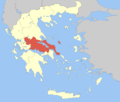
Evrytania Περιφερειακή ενότητα Ευρυτανίας | |
|---|---|
 Municipalities of Evrytania | |
| 39°0′N 21°40′E / 39.000°N 21.667°E / 39.000; 21.667 | |
| Country | Greece |
| Administrative region | Central Greece |
| Seat | Karpenisi |
| Area | |
| • Total | 1,868 km2 (721 sq mi) |
| Population (2021)[1] | |
| • Total | 17,428 |
| • Density | 9.3/km2 (24/sq mi) |
| Time zone | UTC+2 (EET) |
| • Summer (DST) | UTC+3 (EEST) |
| Postal code | 36x xx |
| Area code(s) | 22370 |
| Vehicle registration | ΚΗ |
| Website | www |
Evrytania (Greek: Ευρυτανία [evritaˈni.a]; Latin: Eurytania) is one of the regional units of Greece. It is part of the region of Central Greece. Its capital is Karpenisi (approx. 8,000 inhabitants).
Geography


Evrytania is almost entirely formed of mountains, including the Tymfristos and the Panaitoliko in the south. Its rivers include the Acheloos in the west, Agrafiotis to the east, and Megdova in the east flowing down to the Ionian Sea. It is one of the least populated regional units in Greece. The area borders Aetolia-Acarnania to the west, southwest and south (west over the Acheloos river), Karditsa regional unit to the north, and Phthiotis to the east. Evrytania also features a famous skiing resort located near Karpenisi on the Tymfristos mountain.
Climate
Its climate is a mixture of Mediterranean and mountainous in the western portion. Much of the area receives snow in winter and is warm during the summer months.
Transport
The Greek National Road 38 from Agrinio to Lamia passes through the southern part of Evrytania and the town Karpenisi. On the border with Phthiotis, the GR-38 passes through the 1.4 km-long Tymfristos Tunnel since 2004.
History
Evrytania dates to ancient times, the area was first settled around 6000 to 5000 BC. In classical antiquity, the Greek Eurytanes[2][3] (Greek: Ευρυτάνες) resided in the region. In the 2nd century BC it fell into Roman hands, and became part of the Roman province of Macedonia. At the division of the Roman Empire in the 3rd century it joined the eastern part, also known as the Byzantine Empire. In the aftermath of the Fourth Crusade in 1204 it became part of the Despotate of Epirus, which was conquered by the Ottoman Empire around 1450. Unlike other parts of Greece at the time, while the eastern and the southern parts were definitively ruled by the Ottomans, the area around Agrafa managed to sustain complete autonomy due to the difficulties experienced in conquest of the region. After 400 years, Evrytania finally became part of Greece following the Greek War of Independence. As in all of Greece, the area was affected by World War II, and later the Greek Civil War. Peace finally returned to Evrytania at the end of the 1940s and its economy expanded, though there was significant migration from the villages to cities.
Administration

The regional unit Evrytania is subdivided into 2 municipalities. These are (number as in the map in the infobox):[4]
- Agrafa (2)
- Karpenisi (1)
Prefecture
Evrytania was created as a prefecture in 1947 out of the Aetolia-Acarnania prefecture. As a part of the 2011 Kallikratis government reform, the regional unit Evrytania was created out of the former prefecture Evrytania (Greek: Νομός Ευρυτανίας). The prefecture had the same territory as the present regional unit. At the same time, the municipalities were reorganised, according to the table below.[4]
| New municipality | Old municipalities | Seat |
|---|---|---|
| Agrafa | Agrafa | Kerasochori |
| Aperantia | ||
| Aspropotamos | ||
| Viniani | ||
| Fragkista | ||
| Karpenisi | Karpenisi | Karpenisi |
| Domnista | ||
| Fourna | ||
| Ktimenia | ||
| Potamia | ||
| Prousos |
Persons
- Pavlos Bakoyannis (1935-1989), Liberal Greek politician
- Markos Giolias, artist
- Demosthenis Goulas, artist
- Stefanos Granitsas (1880-1915), artist, writer and journalist
- Georgios Kafantaris (1873-1946), politician
- Spyros Paliouras (1875-1957), a Greek artist and writer
- Zacharias Papantoniou (1877-1940), artist, writer and journalist
- Michael Stafylas (1920-2018), artist
- Lefteris Theodorou, painter
- Spyridon Papadimitriou, General Greek Army,
See also
- List of settlements in Evrytania
- Evrytania (constituency)
References
- ^ "Αποτελέσματα Απογραφής Πληθυσμού - Κατοικιών 2021, Μόνιμος Πληθυσμός κατά οικισμό" [Results of the 2021 Population - Housing Census, Permanent population by settlement] (in Greek). Hellenic Statistical Authority. 29 March 2024.
- ^ Strabo
- ^ Dictionary of Greek and Roman Geography (1854)
- ^ a b "ΦΕΚ A 87/2010, Kallikratis reform law text" (in Greek). Government Gazette.
External links
- Prefecture of Evrytania official website: www.evrytania.gr
- Evrytania
- v
- t
- e
Administrative division of the Central Greece Region
- Area
- 15,549 km2 (6,004 sq mi)
- Population
- 547,390 (as of 2011)
- Municipalities
- 25 (since 2011)
- Capital
- Lamia
- Agrafa
- Karpenisi
- Delphi
- Dorida
- Amfikleia-Elateia
- Domokos
- Kamena Vourla
- Lamia
- Lokroi
- Makrakomi
- Stylida
- Regional governor
- Fanis Spanos (since 2019)
- Decentralized Administration
- Thessaly and Central Greece


