Duduma Waterfalls
Falls between Odisha and Andhra Pradesh in India
18°31′6.68″N 82°27′12.83″E / 18.5185222°N 82.4535639°E / 18.5185222; 82.4535639
Duduma Waterfall is situated in the border of Koraput (Odisha) districts of India.[1][2]
Geography
This horsetail type waterfall is 175 metres (574 ft) in height and is formed by the Machkund river. It has two sub-waterfalls, one on the Odisha side and the other on the Andhra Pradesh side.[citation needed] Duduma is about 92 km from Koraput and about 177 km from Visakhapatnam.
Hydroelectric project
Machhakund (Duduma) Hydroelectric Project is located near Duduma Falls.[3] It is a collaborative project between the Government of Andhra Pradesh and the Government of Odisha. The project, consisting of 6 units, has an installed capacity of 120 MW.
Tourism
Machkund is a pilgrimage destination. The aboriginal tribe of Bonda, Gadaba, and paraja's live near this waterfall.
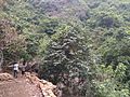
Gallery


See also
References
Wikimedia Commons has media related to Duduma Waterfalls.
- v
- t
- e
Hydrography of Odisha
- Bhargavi
- Baitarani
- Brahmani
- Budhabalanga
- Daya
- Devi
- Dhamra
- Ib
- Indravati
- Kadua
- Kharkai
- Kuakhai
- Koina
- Kolab
- Kushabhadra
- Mahanadi
- Malguni
- Nagavali
- Ong
- Rushikulya
- Sankh
- South Karo
- South Koel
- Subarnarekha
- Surubalijora
- Tel
- Telen
- Vamsadhara
- Taptapani
- Deulajhari
- Atri
- Tarabalo


 | This waterfall-related article is a stub. You can help Wikipedia by expanding it. |
- v
- t
- e


