Currys, Alabama
Unincorporated community in Alabama, United States
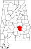
32°01′07″N 86°04′51″W / 32.01861°N 86.08083°W / 32.01861; -86.08083Currys, also known as Lenora, is an unincorporated community in Montgomery County, Alabama, United States. Currys is located on Alabama State Route 94, 35.2 miles (56.6 km) south-southeast of Montgomery. A post office operated under the name Lenora from 1892 to 1905.[2]
References
- ^ "Currys". Geographic Names Information System. United States Geological Survey, United States Department of the Interior.
- ^ "Montgomery County". Jim Forte Postal History. Archived from the original on January 19, 2015. Retrieved January 20, 2015.
- v
- t
- e
Municipalities and communities of Montgomery County, Alabama, United States
County seat: Montgomery
communities
‡This populated place also has portions in an adjacent county or counties
- Alabama portal
- United States portal
 | This Montgomery County, Alabama state location article is a stub. You can help Wikipedia by expanding it. |
- v
- t
- e


