Cunningham, Adams County, Washington
Unincorporated community in Washington, United States
46°49′20″N 118°48′23″W / 46.82222°N 118.80639°W / 46.82222; -118.8063999341
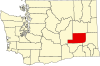
Cunningham is an unincorporated community in Adams County, Washington, United States. It was platted in 1901 by preacher and land promoter W. R. Cunningham.[2]
Cunningham is on the Hatton U.S. Geological Survey Map.[3]
References
- ^ U.S. Geological Survey Geographic Names Information System: Cunningham, Adams County, Washington
- ^ Phillips, James W. (1971). Washington State Place Names. Seattle and London: University of Washington Press. p. 34. ISBN 0-295-95498-1.
- ^ "Cunningham Populated Place Profile / Adams County, Washington Data". washington.hometownlocator.com. Retrieved December 9, 2015.
- v
- t
- e
Municipalities and communities of Adams County, Washington, United States
County seat: Ritzville
- Othello
- Ritzville
community
- Washington portal
- United States portal
 | This Adams County, Washington state location article is a stub. You can help Wikipedia by expanding it. |
- v
- t
- e


