Cooks, Michigan
Unincorporated community in Michigan, United States
45°55′04″N 86°28′35″W / 45.91778°N 86.47639°W / 45.91778; -86.47639[1]49817
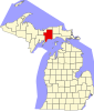
Cooks is an unincorporated community in Schoolcraft County, Michigan, United States. Cooks is located in Inwood Township along the Canadian National Railway north of U.S. Route 2, 11.5 miles (18.5 km) west-southwest of Manistique.[2] Cooks has a post office with ZIP code 49817.[3]
History
Cooks was founded in 1883 when John C. Cook built a sawmill at the community. The community was originally named Cook's Mills before being shortened to Cooks. A post office opened in the community on June 28, 1888; Norman McDonald was the first postmaster. The community had a station on the Minneapolis, St. Paul and Sault Ste. Marie Railroad under the name Cooks Mill.[4]
References
- ^ a b c U.S. Geological Survey Geographic Names Information System: Cooks, Michigan
- ^ Schoolcraft County (pdf) (Map). Michigan Department of Technology, Management and Budget. 2010. Retrieved December 25, 2010.
- ^ ZIP Code Lookup, United States Post Office
- ^ Romig, Walter (1986) [1973]. Michigan Place Names. Detroit, Michigan: Wayne State University Press. ISBN 0-8143-1838-X.
- v
- t
- e
Municipalities and communities of Schoolcraft County, Michigan, United States
County seat: Manistique
communities
‡This populated place also has portions in an adjacent county or counties
- Michigan portal
- United States portal
Authority control databases | |
|---|---|
| International |
|
| National |
|
 | This Schoolcraft County, Michigan location article is a stub. You can help Wikipedia by expanding it. |
- v
- t
- e


