Cocokyun Township
Township of Yangon in Myanmar
Cocokyun Township ကိုကိုးကျွန်း မြို့နယ် | |
|---|---|
Township of Yangon | |
| 14°22′30″N 93°28′30″E / 14.37500°N 93.47500°E / 14.37500; 93.47500 | |
| Country | Myanmar |
| Region | Yangon |
| District | South Yangon |
| Township | Cocokyun |
| Area | |
| • Total | 14.56 sq mi (37.7 km2) |
| Elevation | 366 ft (112 m) |
| Population (2019)MIMU[1] | 1,109 |
| Time zone | UTC6:30 (MMT) |
| Postal codes | 112xx |
| Area code(s) | 1 (mobile: 80, 99) |

This article contains Burmese script. Without proper rendering support, you may see question marks, boxes, or other symbols instead of Burmese script.
Cocokyun Township (or Cocogyun) (Burmese: ကိုကိုးကျွန်း မြို့နယ်, Kokògyùn Myónae) is located on the islands of Coco and Preparis, in Myanmar. The township, made up of two wards, is rural and underdeveloped because of its distance from the mainland. Preparis Ward is the smaller ward, having a population of only 50 residents. Cocos Ward is the larger ward, having all the local government infrastructure, and around 1,900 villagers.
The township was formerly part of the Hanthawaddy District in 1965 when it was assigned as a municipal territory of the defence forces. In 1999, the township and its two wards were created by the Myanmar Navy and Ministry of Home Affairs.[1]
Demographics
| Year | Cocokyun Township | ±% |
|---|---|---|
| 2014 | 1,940 | — |
| 2018 | 1,115 | −42.5% |
| 2019 | 1,109 | −0.5% |
| Source: 2014 Census[2] and General Administration Department data[1] | ||
Cocokyun has two schools. There are 81 females for every 100 males in the township. In 2018, 149 people left the township and 143 people moved to the township. 100% of the island's population is Buddhist.[1]
References
- ^ a b c d Myanmar Information Management Unit (October 2019). Kokokyun Myone Daethasaingyarachatlatmya ကိုကိုးကျွန်းမြို့နယ် ဒေသဆိုင်ရာအချက်လက်များ [Cocokyun Township Regional Information] (PDF) (Report). MIMU. Retrieved 15 May 2023.
- ^ Census data
- v
- t
- e
Districts/Townships of Yangon
Capital: Yangon
- Dala Township
- Seikkyi Kanaungto Township
- Cocokyun Township
- Kawhmu Township
- Kayan Township
- Kungyangon Township
- Kyauktan Township
- Thanlyin Township
- Thongwa Township
- Twante Township
- Tada Subtownship
(Downtown)
1 - part of South Yangon City; 2 - part of North Yangon City
| ||
|---|---|---|
Capital: Yangon | ||
| East Yangon District |  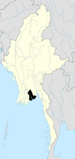 | |
| North Yangon District | ||
| South Yangon District |
| |
| West Yangon District (Downtown) | ||
| Main cities and towns | ||
1 - part of South Yangon City; 2 - part of North Yangon City | ||
| ||
|---|---|---|
| States |  | |
| Regions | ||
| Self-Administered Zones | ||
| Self-Administered Divisions | ||
| Union Territories | ||
 Myanmar portal Myanmar portal | ||
 | This Yangon Region location article is a stub. You can help Wikipedia by expanding it. |
- v
- t
- e


