Chūbu-Sangaku National Park
National Park in Chūbū, Japan
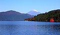
36°45′30″N 137°47′30″E / 36.75833°N 137.79167°E / 36.75833; 137.79167Chūbu-Sangaku National Park (中部山岳国立公園, Chūbu Sangaku Kokuritsu Kōen) is a national park in the Chūbu region of Japan. It was established around the Hida Mountains and encompasses parts of Nagano, Gifu, Toyama and Niigata prefectures. It was designated a national park on December 4, 1934, along with Daisetsuzan National Park, Akan National Park, Nikkō National Park, and Aso Kujū National Park.[1]
Geography
The Hida Mountains, or Northern Alps make up the majority of the park. There are many points in the Hida Mountains within the park that are above 3,000 m (9,843 ft), including Kamikōchi, Mount Norikura, Mount Hotaka and Mount Tate. The park is home to numerous gorges, ravines, and dramatically shaped escarpments,[1] as well as the headwater of Japan's longest river, the Shinano River, which begins here as the Azusa River on the southeastern slope of Mount Yari.[2]
Recreation
The Chūbu-Sangaku National Park has become the most important hiking area in Japan.[1] Often tourists visit the nearby mountainous highland valley, Kamikochi.
See also
- List of national parks of Japan
- Tateyama Kurobe Alpine Route
- Japanese Alps
- Tateyama, Toyama
- Midagahara
- Murodō Station
- Kurobe Gorge
- Kurobe Gorge Railway
- Kurobe dam
- Tourism in Japan
References
- ^ a b c "Chūbu Sangaku National Park". Encyclopedia of Japan. Tokyo: Shogakukan. 2012. OCLC 56431036. Archived from the original on 2007-08-25. Retrieved 2012-07-25.
- ^ 千曲川・犀川のすがた平成19年3月27日), Ministry of Land, Infrastructure, Transport and Tourism. Retrieved on 2022-08-27. (in Japanese)
External links
Wikimedia Commons has media related to Chubu-Sangaku National Park.
- Chubusangaku National Park Southern Region Official Site
- v
- t
- e
- Akan
- Amami Guntō
- Ashizuri-Uwakai
- Aso-Kujū
- Bandai-Asahi
- Chichibu-Tama-Kai
- Chūbu-Sangaku
- Daisen-Oki
- Daisetsuzan
- Fuji-Hakone-Izu
- Hakusan
- Iriomote-Ishigaki
- Ise-Shima
- Jōshinetsu Kōgen
- Kerama Shotō
- Kirishima-Kinkowan
- Kushiro Shitsugen
- Minami Alps
- Myōkō-Togakushi Renzan
- Nikkō
- Ogasawara
- Oze
- Rishiri-Rebun-Sarobetsu
- Saikai
- Sanin Kaigan
- Sanriku Fukkō
- Setonaikai
- Shikotsu-Tōya
- Shiretoko
- Towada-Hachimantai
- Unzen-Amakusa
- Yanbaru
- Yakushima
- Yoshino-Kumano
- Abashiri
- Aichi Kōgen
- Akiyoshidai
- Biwako
- Chōkai
- Echigo Sanzan-Tadami
- Echizen-Kaga Kaigan
- Genkai
- Hayachine
- Hiba-Dōgo-Taishaku
- Hida-Kisogawa
- Hidaka-sanmyaku Erimo
- Hyōnosen-Ushiroyama-Nagisan
- Ibi-Sekigahara-Yōrō
- Iki-Tsushima
- Ishizuchi
- Kita Nagato
- Kitakyūshū
- Kongō-Ikoma-Kisen
- Kōya-Ryūjin
- Kurikoma
- Kyoto Tamba Kōgen
- Kyūshū Chūō Sanchi
- Meiji no Mori Minō
- Meiji no Mori Takao
- Mikawa Wan
- Minami Bōsō
- Minami Sanriku Kinkasan
- Murō-Akame-Aoyama
- Muroto-Anan Kaigan
- Myōgi-Arafune-Saku Kōgen
- Nichinan Kaigan
- Nippō Kaigan
- Niseko-Shakotan-Otaru Kaigan
- Nishi-Chūgoku Sanchi
- Noto Hantō
- Oga
- Okinawa Kaigan
- Okinawa Senseki
- Ōnuma
- Sado-Yahiko-Yoneyama
- Shimokita Hantō
- Shokanbetsu-Teuri-Yagishiri
- Sobo Katamuki
- Suigō-Tsukuba
- Suzuka
- Tango-Amanohashidate-Ōeyama
- Tanzawa-Ōyama
- Tenryū-Okumikawa
- Tsugaru
- Tsurugisan
- Wakasa Wan
- Yaba-Hita-Hikosan
- Yamato-Aogaki
- Yatsugatake-Chūshin Kōgen
- Zaō
Authority control databases | |
|---|---|
| International |
|
| National |
|


