Carlisle, Louisiana
Unincorporated community in Louisiana, United States
29°41′13″N 89°57′44″W / 29.68694°N 89.96222°W / 29.68694; -89.9622270040[1]
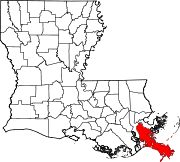
Carlisle is an unincorporated community in Plaquemines Parish, Louisiana, United States. Carlisle is located on the east bank of the Mississippi River and Louisiana Highway 39, 19.3 miles (31.1 km) south-southeast of New Orleans.[3]
References
- ^ United States Postal Service (2012). "USPS - Look Up a ZIP Code". Retrieved February 15, 2012.
- ^ "Carlisle". Geographic Names Information System. United States Geological Survey, United States Department of the Interior.
- ^ Plaquemines Parish Northwest Section (PDF) (Map). Louisiana Department of Transportation and Development. 2012. Archived from the original (PDF) on August 30, 2012. Retrieved September 2, 2012.
- v
- t
- e
Municipalities and communities of Plaquemines Parish, Louisiana, United States
Parish seat: Pointe à la Hache

communities
- Louisiana portal
- United States portal
 | This Louisiana state location article is a stub. You can help Wikipedia by expanding it. |
- v
- t
- e


