Capitol, Montana
Populated place in Montana, United States
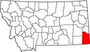
Capitol is a populated place in Carter County, Montana, United States.[1]
Geography
Capitol is located at 45°26′10″N 104°03′54″W / 45.43611°N 104.065°W / 45.43611; -104.065. Its elevation is 3,183 ft (970 m).[1]
Capitol was named after Capitol Rock, a prominent landmark in the nearby Long Pine Hills.[2] Capitol is located on the Little Missouri River and close to the South Dakota border.
Post Office
Capitol had a post office from 1891 to 1982. Residents who have a Capitol address receive their mail from the neighboring post office of Camp Crook, South Dakota.

Church
A church named 'Little Missouri Lutheran Church' is located near Capitol. The congregation celebrated its 125th anniversary in 2014. The church was established 5 months before Montana became a state.
Cemeteries
Capitol Cemetery is located northeast of town on Little Missouri Road. The Little Missouri Lutheran Church Cemetery is located behind the current church location.
References
- ^ a b U.S. Geological Survey Geographic Names Information System: Capitol, Montana
- ^ "Capitol". Montana Place Names Companion. Montana Historical Society. Retrieved 2 April 2021.
- v
- t
- e
Municipalities and communities of Carter County, Montana, United States
County seat: Ekalaka
- Ekalaka
- Alzada
communities
- Boyes
- Capitol
- Hammond
- Mill Iron
- Ridge
‡This populated place also has portions in an adjacent county or counties
- Montana portal
- United States portal
 | This Carter County, Montana state location article is a stub. You can help Wikipedia by expanding it. |
- v
- t
- e


