Cannonsville Reservoir
Reservoir in Delaware County, New York
West Delaware Tunnel
The Cannonsville Reservoir is a reservoir in the New York City water supply system in Delaware County, New York. It was formed by construction of the Cannonsville Dam on its west end,[2] which impounded over half of the West Branch of the Delaware River. Lying on the western part of the Delaware Watershed, it is the westernmost of New York City's reservoirs. It was placed in service in 1964, and is the most recently constructed New York City-owned reservoir.
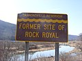
The town of Cannonsvile was destroyed to make room for the reservoir, which lies within the towns of Tompkins and Deposit.
Its 455 square miles (1,180 km2) drainage basin is the largest of all of the NYC reservoirs. Capacity is 95.7 billion US gallons (362,000,000 m3). Water from the reservoir flows through the 44-mile (71 km) West Delaware Tunnel into the Rondout Reservoir, before joining the 85-mile (137 km) Delaware Aqueduct, which provides New York City with about 50% of its drinking water.
The Delaware Aqueduct then crosses beneath the Hudson River and continues on to the West Branch Reservoir in Putnam County, New York, then the Kensico Reservoir in Westchester County, both north of the city. It then continues further south to the Hillview Reservoir in Yonkers, where it joins the flows of the Catskill and New Croton aqueducts for distribution through the New York City tunnel system.
The Cannonsville Dam is being considered as a site for a 14.08MW hydroelectric generating station.[3]
Recreation
No motor boats are allowed on the reservoir; non-motorized boats that have been steam-cleaned and that have required tags may be used in the reservoir during the summer.[4]
Tributaries
- Johnny Brook
- Dry Brook
- Sherruck Brook
- Trout Creek
- Loomis Brook
- Chamberlain Brook
- Dryden Brook
- Maxwell Brook
- Fish Brook
-
 Aerial view of Cannonsville Reservoir
 -
 The entrance to the Cannonsville Reservoir
 -
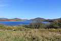 Cannonsville Reservoir at Deposit


See also
References
- ^ a b "Cannonsville Reservoir". Geographic Names Information System. United States Geological Survey, United States Department of the Interior. Retrieved 2018-09-23.
- ^ "Cannonsville Dam". Geographic Names Information System. United States Geological Survey, United States Department of the Interior. Retrieved 2018-09-23.
- ^ "BEFORE THE FEDERAL ENERGY REGULATORY COMMISSION APPLICATION FOR LICENSE FOR MAJOR PROJECT – EXISTING DAM" (PDF). www.nyc.gov. Archived from the original (PDF) on 2014-02-17. Retrieved 2014-09-22.
- ^ Boating, New York City Department of Environmental Protection. Accessed October 4, 2023. "All boaters must obtain a free DEP Access Permit and all boats must be steam cleaned by a DEP certified steam cleaning vendor before being placed on a resevoir[sic].... Recreational boating (boating for non-anglers) is allowed on Cannonsville, Pepacton, Neversink and Schoharie Reservoirs during the summer.... Non-motorized kayaks, canoes, rowboats, and sculls with the appropriate recreational boat tags may be used."
External links
Wikimedia Commons has media related to Cannonsville Reservoir.
- Final Environmental Assessment for Hydropower License Archived 2015-10-04 at the Wayback Machine
- v
- t
- e
- New Croton
- Old Croton
- Catskill
- Shandaken
- Delaware
- Neversink
- East Delaware
- West Delaware
Italics indicate a decommissioned site
| Authority control databases |
|
|---|


