Bolívar Partido
Department in Argentina
Bolívar Partido de Bolívar | |
|---|---|
Department | |
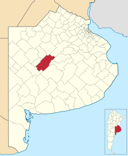 Location of Bolívar Partido in Buenos Aires Province | |
| Coordinates: 36°14′S 61°07′W / 36.233°S 61.117°W / -36.233; -61.117 | |
| Country | Argentina |
| Established | March 2, 1938 |
| Seat | San Carlos de Bolívar |
| Government | |
| • Mayor | Jose "Bali" Bucca |
| Area | |
| • Total | 5,027 km2 (1,941 sq mi) |
| Population | |
| • Total | 32,442 |
| • Density | 6.5/km2 (17/sq mi) |
| Demonym | bolivarense |
| Postal Code | B6550 |
| IFAM | BUE015 |
| Area Code | 02314 |
| Website | http://www.bolivar.gov.ar[permanent dead link] |
Bolívar Partido is a partido (second level administrative subdivision) located in central Buenos Aires Province, Argentina.
The partido has 5,027 km² (1,941 sq mi) and a population of 32,442 (2001 census [INDEC]), and its capital is San Carlos de Bolívar.
Settlements
- San Carlos de Bolívar
- Hale
- Juan F. Ibarra
- Mariano Unzué
- Paula (Est. La Paula)
- Pirovano
- Villa Lynch Pueyrredón
- Vallimanca
- Urdampilleta
- Santander, origen España
External links
- (in Spanish)Official site of Gobierno Municipal del Partido de Bolívar
- (in Spanish)Tourism Bolívar
- (in Spanish) Federal website
- (in Spanish) La Mañana, Bolívar newspaper
- v
- t
- e
Partidos of Buenos Aires Province
- Adolfo Alsina
- Adolfo Gonzáles Chaves
- Alberti
- Almirante Brown
- Arrecifes
- Avellaneda
- Ayacucho
- Azul
- Bahía Blanca
- Balcarce
- Baradero
- Benito Juarez
- Berazategui
- Berisso
- Bolívar
- Bragado
- Brandsen
- Campana
- Cañuelas
- Capitán Sarmiento
- Carlos Casares
- Carlos Tejedor
- Carmen de Areco
- Castelli
- Chacabuco
- Chascomús
- Chivilcoy
- Colón
- Coronel Dorrego
- Coronel Pringles
- Coronel Rosales
- Coronel Suárez
- Daireaux
- Dolores
- Ensenada
- Escobar
- Esteban Echeverría
- Exaltación de la Cruz
- Ezeiza
- Florencio Varela
- Florentino Ameghino
- General Alvarado
- General Alvear
- General Arenales
- General Belgrano
- General Guido
- General La Madrid
- General Las Heras
- General Lavalle
- General Madariaga
- General Paz
- General Pinto
- General Pueyrredón
- General Rodríguez
- General San Martín
- General Viamonte
- General Villegas
- Guaminí
- Hipólito Yrigoyen
- Hurlingham
- Ituzaingó
- José C. Paz
- Junín
- La Costa
- La Matanza
- La Plata
- Lanús
- Laprida
- Las Flores
- Leandro N. Alem
- Lezama
- Lincoln
- Lobería
- Lobos
- Lomas de Zamora
- Luján
- Magdalena
- Maipú
- Malvinas Argentinas
- Mar Chiquita
- Marcos Paz
- Mercedes
- Merlo
- Monte
- Monte Hermoso
- Moreno
- Morón
- Navarro
- Necochea
- Nueve de Julio
- Olavarría
- Patagones
- Pehuajó
- Pellegrini
- Pergamino
- Pila
- Pilar
- Pinamar
- Presidente Perón
- Puán
- Punta Indio
- Quilmes
- Ramallo
- Rauch
- Rivadavia
- Rojas
- Roque Pérez
- Saavedra
- Saladillo
- Salliqueló
- Salto
- San Andrés de Giles
- San Antonio de Areco
- San Cayetano
- San Fernando
- San Isidro
- San Miguel
- San Nicolás
- San Pedro
- San Vicente
- Suipacha
- Tandil
- Tapalqué
- Tigre
- Tordillo
- Tornquist
- Trenque Lauquen
- Tres Arroyos
- Tres de Febrero
- Tres Lomas
- Veinticinco de Mayo
- Vicente López
- Villa Gesell
- Villarino
- Zárate


Authority control databases | |
|---|---|
| International |
|
| National |
|
 | This article about a place in Buenos Aires Province, Argentina is a stub. You can help Wikipedia by expanding it. |
- v
- t
- e


