Bierbeek
Municipality in Flemish Community, Belgium

Flag

Coat of arms
Location of Bierbeek


Bierbeek
Location in Belgium 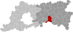
Location of Bierbeek in Flemish Brabant

 Belgium
 (2018-01-01)[1]
3360
24011
Bierbeek (Dutch pronunciation: [ˈbiːrbeːk] ⓘ) is a municipality located in the Belgian province of Flemish Brabant. The municipality comprises the towns of Bierbeek proper, Korbeek-Lo, Lovenjoel and Opvelp. On January 1, 2006, Bierbeek had a total population of 9,147. The total area is 39.73 km2 which gives a population density of 230 inhabitants per km2.
Born
- Gaston Roelants (born 1937), athlete
- Frederik Veuchelen (born 1978), cyclist
References
- ^ "Wettelijke Bevolking per gemeente op 1 januari 2018". Statbel. Retrieved 9 March 2019.
External links
 Media related to Bierbeek at Wikimedia Commons
- Official website - Available only in Flemish
Places adjacent to Bierbeek | ||||||||||||||||
|---|---|---|---|---|---|---|---|---|---|---|---|---|---|---|---|---|
| ||||||||||||||||


- v
- t
- e
- Affligem
- Asse
- Beersel
- Bever
- Dilbeek
- Drogenbos
- Galmaarden
- Gooik
- Grimbergen
- Halle
- Herne
- Hoeilaart
- Kampenhout
- Kapelle-op-den-Bos
- Kraainem
- Lennik
- Liedekerke
- Linkebeek
- Londerzeel
- Machelen
- Meise
- Merchtem
- Opwijk
- Overijse
- Pepingen
- Roosdaal
- Sint-Genesius-Rode
- Sint-Pieters-Leeuw
- Steenokkerzeel
- Ternat
- Vilvoorde
- Wemmel
- Wezembeek-Oppem
- Zaventem
- Zemst

- Bold indicates cities
- Italic indicates municipalities with language facilities
Authority control databases | |
|---|---|
| International |
|
| Geographic |
|
 | This Flemish Brabant location article is a stub. You can help Wikipedia by expanding it. |
- v
- t
- e


