Beesel
Municipality in Limburg, Netherlands
Beesel Bezel | |
|---|---|
 Wind mill in Beesel | |
 Flag  Coat of arms | |
 Location in Limburg | |
| Coordinates: 51°17′N 6°2′E / 51.283°N 6.033°E / 51.283; 6.033 | |
| Country | Netherlands |
| Province | Limburg |
| Government | |
| • Body | Municipal council |
| • Mayor | Bob Vostermans |
| Area | |
| • Total | 29.15 km2 (11.25 sq mi) |
| • Land | 27.99 km2 (10.81 sq mi) |
| • Water | 1.16 km2 (0.45 sq mi) |
| Elevation | 25 m (82 ft) |
| Population (January 2021)[4] | |
| • Total | 13,450 |
| • Density | 481/km2 (1,250/sq mi) |
| Time zone | UTC+1 (CET) |
| • Summer (DST) | UTC+2 (CEST) |
| Postcode | 5953–5954 |
| Area code | 077 |
| Website | www |
Beesel (Dutch: [ˈbeːzəl] ⓘ; Limburgish: Bezel [ˈbeːzəl])[tone?] is a municipality and a town in the province of Limburg in the southeastern Netherlands.
Population centres
- Beesel
- Offenbeek
- Reuver
Topography

Topographic map of the municipality of Beesel, June 2015.
The town of Beesel
The town of Beesel lies about 10 km north of Roermond. Although the municipality is named after this village, it is not the largest town in the municipality, and neither is the municipal hall located in Beesel.
In 2001, Beesel had 7382 inhabitants. The built-up area of the town was 0.53 km², and contained 706 residences.[5]

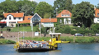
Transportation
Notable people
- Mark Jansen (born 1978 in Reuver) a Dutch guitarist, vocalist and songwriter, worked with the symphonic metal band After Forever
- Sander Gommans (born 1978 in Reuver) a Dutch musician with symphonic metal band After Forever
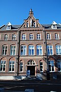
Gallery
-
 Beesel, - panoramio
 -
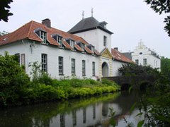
 Ronckenstein
 -
 Heilig Hartklooster, Reuver
 -
 Nieuwenbroek


References
- ^ "Burgemeester Vostermans" [Mayor Vostermans] (in Dutch). Gemeente Beesel. Archived from the original on 23 September 2015. Retrieved 13 October 2013.
- ^ "Kerncijfers wijken en buurten 2020" [Key figures for neighbourhoods 2020]. StatLine (in Dutch). CBS. 24 July 2020. Retrieved 19 September 2020.
- ^ "Postcodetool for 5953AL". Actueel Hoogtebestand Nederland (in Dutch). Het Waterschapshuis. Retrieved 13 October 2013.
- ^ "Bevolkingsontwikkeling; regio per maand" [Population growth; regions per month]. CBS Statline (in Dutch). CBS. 1 January 2021. Retrieved 2 January 2022.
- ^ Statistics Netherlands (CBS), Bevolkingskernen in Nederland 2001 "CBS - Bevolkingskernen in Nederland 2001". Archived from the original on 2006-03-19. Retrieved 2007-01-24.. Statistics are for the continuous built-up area.
External links
 Media related to Beesel at Wikimedia Commons
- Official website


- v
- t
- e
Municipalities of Limburg
- Beek
- Beekdaelen
- Beesel
- Bergen
- Brunssum
- Echt-Susteren
- Eijsden-Margraten
- Gennep
- Gulpen-Wittem
- Heerlen
- Horst aan de Maas
- Kerkrade
- Landgraaf
- Leudal
- Maasgouw
- Maastricht
- Meerssen
- Mook en Middelaar
- Nederweert
- Peel en Maas
- Roerdalen
- Roermond
- Simpelveld
- Sittard-Geleen
- Stein
- Vaals
- Valkenburg aan de Geul
- Venlo
- Venray
- Voerendaal
- Weert

- See also
- Netherlands
- Provinces
- Municipalities
| Authority control databases |
|
|---|
 | This Dutch Limburg location article is a stub. You can help Wikipedia by expanding it. |
- v
- t
- e


