Balurghat Airport
Airport of West Bengal, India
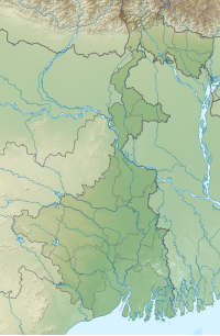

RGH
Location of airport in West Bengal
Show map of West Bengal
RGH
RGH (India)
Show map of India| Direction | Length | Surface | |
|---|---|---|---|
| ft | m | ||
| 09/27 | 4,906 | 1,495 | Paved |
Balurghat Airport (IATA: RGH, ICAO: VEBG) is located 6 km (4 mi) from Balurghat and 34 km (21 mi) away from Gangarampur, a city in West Bengal, India.[1] The airport is currently not in operation.[3]
History
During the World War II, a temporary airport was built by the British in Balurghat for military needs. In the 1950s, the Surekha Air Service started flying from there until it was stopped during the India-Pakistan war. Finally, in 1984, Vayudoot operated out of the airport. But these flights stopped due to lack of navigation systems, lack of passengers, and financial losses.[4]
Facilities
The airport covers an area of 132.66 acres (53.69 ha) at an elevation of 78 feet (24 m) above mean sea level. It has one runway designated 9/27 with a paved surface measuring 4,906 by 100 feet (1,495 m × 30 m).[1][5]
Extension
The Government of West Bengal had planned to launch air services from the Balurghat Airport in March 2018. The government had allocated around ₹11.35 crores for the up-gradation & extension of the air-strip, passenger lounge, air traffic, restroom of crews and pilots, need-based restaurants, refreshment counters. Airport Authority of India had visited the airport for approvals.[6]
See also
- List of airports by ICAO code: V#VA VE VI VO - India
- List of airports in India
References
- ^ a b c "Balurghat Airport". Airports Authority of India. Archived from the original on 5 May 2009.
- ^ Airport information for Balurghat, India (VEBG / RGH) at Great Circle Mapper.
- ^ "Deal with Changi on Durgapur airport". The Telegraph. 28 February 2008. Archived from the original on 4 February 2013.
However, there are over 40 non-operational airports under the authority (Airports Authority of India). In Bengal, there are two of them — in Malda and Balurghat.
- ^ "বালুরঘাট বিমানবন্দরে উড়ান শুরু হতে আর বেশি দেরি নেই". m.bangla.eenaduindia.com moving. Archived from the original on 28 March 2018. Retrieved 28 March 2018.
- ^ "Full-fledged air services from Balurghat to kick off from April". Millenniumpost. 16 March 2018. Retrieved 17 March 2018.
- ^ "Balurghat airport likely to begin services April-end". 16 March 2018.
External links
- Accident history for RGH at Aviation Safety Network
- v
- t
- e
International | |||||||||||
|---|---|---|---|---|---|---|---|---|---|---|---|
| |||||||||||
Domestic/private | |||||||||||||||||||||||||||||||||||||||||||||||||||||||||||||||||||||||
|---|---|---|---|---|---|---|---|---|---|---|---|---|---|---|---|---|---|---|---|---|---|---|---|---|---|---|---|---|---|---|---|---|---|---|---|---|---|---|---|---|---|---|---|---|---|---|---|---|---|---|---|---|---|---|---|---|---|---|---|---|---|---|---|---|---|---|---|---|---|---|---|
| |||||||||||||||||||||||||||||||||||||||||||||||||||||||||||||||||||||||
Proposed | |||||||||||||||||||||||
|---|---|---|---|---|---|---|---|---|---|---|---|---|---|---|---|---|---|---|---|---|---|---|---|
| |||||||||||||||||||||||
Military | |||||||||||||||||||||||||||||||||
|---|---|---|---|---|---|---|---|---|---|---|---|---|---|---|---|---|---|---|---|---|---|---|---|---|---|---|---|---|---|---|---|---|---|
| |||||||||||||||||||||||||||||||||
State-wise list of airports | |
|---|---|
|


