Ards Lower
Place in Northern Ireland, United Kingdom
Ards Lower An Aird Íochtarach[1] (Irish) | |
|---|---|
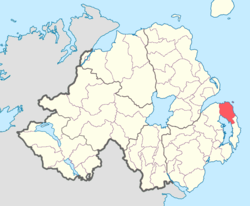 Location of Ards Lower, County Down, Northern Ireland. | |
| Coordinates: 54°35′54.89″N 5°36′17.10″W / 54.5985806°N 5.6047500°W / 54.5985806; -5.6047500 | |
| Sovereign state | United Kingdom |
| Country | Northern Ireland |
| County | Down |
Ards Lower (named after the former barony of Ards), alternatively known as North Ards, is a barony in County Down, Northern Ireland.[2] It lies on the northern half of the Ards Peninsula in the north-east of the county, with the Irish Sea to its east and Strangford Lough to its south-west. It is bordered by two other baronies: Ards Upper to the south; and Castlereagh Lower to the west.[2]
The barony of Ards Lower was created in 1851 when the barony of Ards was split into two, the other part being Ards Upper.[3]
List of settlements
Below is a list of settlements in Ards Lower:[1][4]
Towns
- Bangor (also partly in barony of Castlereagh Lower)
- Donaghadee
- Newtownards (also partly in barony of Castlereagh Lower)
Villages
- Carrowdore
- Conlig
- Greyabbey
- Groomsport
- Millisle
Population centres
- Clandeboye (split with the barony of Castlereagh Lower)
- Kilcooley
List of civil parishes
Below is a list of civil parishes in Ards Lower:[1][5][4]
- Bangor (also partly in barony of Castlereagh Lower)
- Donaghadee
- Greyabbey
- Newtownards (also partly in barony of Castlereagh Lower)
References
- v
- t
- e
Places in County Down

and townlands
- Annahilt
- Annalong
- Annsborough
- Ardglass
- Attical
- Aughnacloy
- Ballela
- Balloo
- Ballybannan
- Ballydargan
- Ballygowan
- Ballyhalbert
- Ballyhay
- Ballyholme
- Ballyhornan
- Ballykinler
- Ballylesson
- Ballylough
- Ballymacmaine
- Ballymartin
- Ballynagarrick
- Ballynahatty
- Ballynoe
- Ballyskeagh
- Ballywalter
- Benraw
- Blackskull
- Bleary
- Braniel
- Bryansford
- Burren
- Cabra
- Carnalea
- Carrowdore
- Castlewellan
- Clandeboye
- Cloghy
- Clough
- Conlig
- Corbet
- Crawfordsburn
- Cregagh
- Crossgar
- Cultra
- Derryneill
- Dollingstown
- Donaghcloney
- Dromara
- Drumaness
- Drumbeg
- Drumbo
- Drumlough, Hillsborough
- Drumlough, Rathfriland
- Dundrum
- Dunnaval
- Edenderry
- Gamblestown
- Gilford
- Gilnahirk
- Gransha
- Greencastle
- Greyabbey
- Groomsport
- Helen's Bay
- Hillhall
- Hillsborough
- Hilltown
- Katesbridge
- Kilcoo
- Kilcooley
- Killinchy
- Killinure
- Killough
- Killowen
- Killyleagh
- Kinallen
- Kircubbin
- Lawrencetown
- Legacurry
- Legananny
- Leitrim
- Lenaderg
- Loughbrickland
- Loughinisland
- Lurganare
- Lurganville
- Magheraconluce
- Magheralin
- Mayobridge
- Maze
- Millisle
- Moira
- Moneyreagh
- Moneyslane
- Monteith
- Newtownbreda
- Portaferry
- Portavogie
- Poyntzpass
- Rathfriland
- Ravernet
- Ringhaddy
- Rostrevor
- Saintfield
- Saul
- Scarva
- Seaforde
- Seahill
- Sheeptown
- Shrigley
- Spa
- Strangford
- Struell
- Tievenadarragh
- Tullylish
- Tullynakill
- Waringsford
- Waringstown
- Whiterock
- Ards Lower
- Ards Upper
- Castlereagh Lower
- Castlereagh Upper
- Dufferin
- Iveagh Lower
- Iveagh Upper
- Kinelarty
- Lecale Lower
- Lecale Upper
- Lordship of Newry
- Mourne
- WikiProject Northern Ireland
- WikiProject Ireland
- Northern Ireland Portal
- United Kingdom Portal
- Ireland Portal


