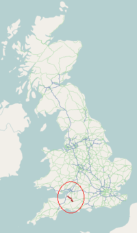
A371 road
Primary road in England running from Wincanton in Somerset, to Weston-super-Mare in North Somerset
 | |
|---|---|
 | |
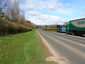 A371 near Bath and West showground, Shepton Mallet | |
| Route information | |
| Length | 37.6 mi (60.5 km) |
| 51°02′54″N 2°25′06″W / 51.0484°N 2.4182°W / 51.0484; -2.4182 (A371 road (southeastern end)) | |
| Major intersections |  A303 A303 A359 A359 A37 A37 A361 A361 A39 A39 A38 A38 A368 A368 A370 A370 |
| North West end | Weston-super-Mare 51°20′39″N 2°55′54″W / 51.3443°N 2.9317°W / 51.3443; -2.9317 (A371 road (northwestern end)) |
| Location | |
| Country | United Kingdom |
| Road network | |
The A371 is a primary road in England running from Wincanton to Weston-super-Mare in North Somerset, through Shepton Mallet, Croscombe, Wells, Westbury-sub-Mendip, Rodney Stoke, Draycott, Cheddar, Axbridge, Winscombe, Banwell and Weston-super-Mare.
The A371 starts at the A303, then passes Castle Cary, Ansford, Cannard's Grave (where it briefly joins the A37), Shepton Mallet, Croscombe, Wells, Westbury-sub-Mendip, Rodney Stoke, Draycott, Cheddar, Axbridge (where it briefly joins the A38), Winscombe, Banwell and Locking before finishing at the A370.[1]
En route the A371 passes through the Mendip Hills and near to some major tourist destinations such as the Bath and West showground, Wells Cathedral, Wookey Hole Caves, Cheddar Gorge and The Helicopter Museum and Junction 21 Enterprise Area where the road finishes in Weston-super-Mare.[1]
When first classified in 1922, the section of A371 between Wincanton and Shepton Mallet was designated as part of the A357. It's unclear why the road was renumbered.
References
Map all coordinates using OpenStreetMap
Download coordinates as:
- KML
- GPX (all coordinates)
- GPX (primary coordinates)
- GPX (secondary coordinates)
- ^ a b "A371". SABRE. Retrieved 13 November 2010.

 | This England road or road transport-related article is a stub. You can help Wikipedia by expanding it. |
- v
- t
- e


